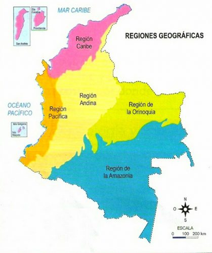
I'm currently working with some data at a "state"(Different nomenclature in my country) and regional level for my country (Colombia) that I want to graph in a map. I searched for a shapefile for my country and was surprised by the amount of shapefiles available for Colombia that state institutions provide, anyway I need a shapefile with the regional division for my country and the problem is that I have searched and I can not seem to find this shapefile, and the institution that provides this data are currently unable to provide me with one (thats what they say).
I do have the shapefile with the state division which contains all states and from this I thought I could join different states to form the regions that I need in a new shapefile so I was hoping if you could tell me if there is a way to do this in Stata?
Thank you for your time and help. I attached two images to help you visualize what I want to do.
what I currently have in a shapefile:
What Im aiming to create in a new shapefile from the one above:

0 Response to Create a new shapefile from another
Post a Comment